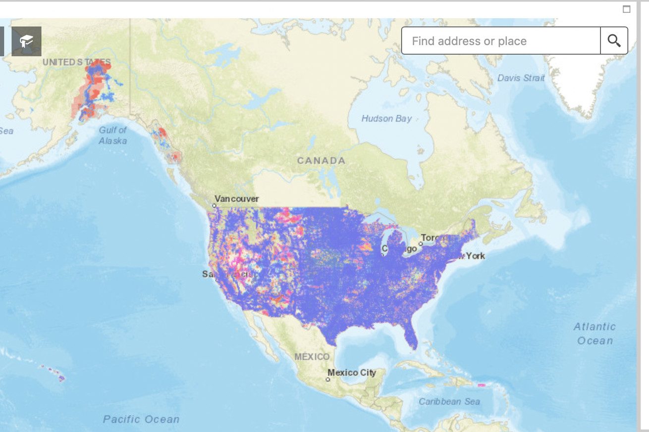

Pictured: the FCC’s map of LTE coverage in the US. | Image: FCC
Cell network coverage maps have always been dubiously accurate in the US, and even the ones released by the FCC in 2021 come with a ton of asterisks. A company called Ranlytics is hoping to make a much more accurate picture by attaching equipment to some of the mail trucks that are already driving to most addresses in the US to deliver parcels and letters.
In a press release earlier this week, Ranlytics says it’s working with the US Postal Service to measure AT&T, T-Mobile, and Verizon’s 4G and 5G networks in Seattle and that it’s already producing “the most detailed available” coverage maps for select areas in the city. (It says the equipment it uses is also capable of mapping 3G networks, but those are largely gone in the US.) The company also says that it can track coverage changes over time, finding both places where coverage doesn’t exist and where there is coverage but a lackluster user experience.
/cdn.vox-cdn.com/uploads/chorus_asset/file/24424039/63e37236105ac163884082f9_20230208_IMG01.png?w=640&ssl=1)
Image: Ranlytics
One of the LTE maps Ranlytics has generated in Seattle.
Ranlytics says it “aims to accurately measure and map mobile coverage nationwide” in the United States and other countries as well. An unnamed official for the company told Light Reading that the USPS has agreed to “expand its network-monitoring efforts across the US.” The company hopes that it’ll then be able to sell that data to carriers, the government, and others that would have a use for it.
Building these types of maps can be difficult, even for the cell carriers that run the networks and the government. The FCC’s cellular maps rely on data from the carriers, which historically haven’t been the most trustworthy sources. They also don’t include information about how fast those networks will be at any given location, and they currently only show information for LTE networks — a big limitation in the age of 5G.
There are limits to Ranlytics’ approach. For one, equipment attached to USPS vehicles will obviously only gather data on roads and where mail is delivered — that could exclude large swaths of land like national parks or rural homes where the mail may not be delivered directly to the home. It’s also unclear if Ranlytics and the USPS plan to attach equipment to the personal vehicles that are sometimes used to deliver mail in rural areas instead of vehicles owned by the post office. (The company’s site does say that its equipment can be installed on “any vehicle type.”)
Despite the fact that it’s potentially difficult to get, data about internet availability in less densely populated places is essential for addressing the digital divide that exists between places that have internet good enough to work or learn from home and those that don’t. We’ve reached out to Ranlytics to ask about rural routes and will let you know if we hear back.


More Stories
Will County, Illinois 1864 Map – May 20, 2023 at 04:14AM
This kid on Google Map trying to get by – April 27, 2023 at 05:05PM
World of Hyatt: Complete list of all-inclusive properties in Europe (with map) – April 27, 2023 at 04:57PM