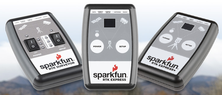
Over the last year, we have endeavored to create the most affordable, yet highly accurate, real-time kinematic (RTK) positioning options currently available. SparkFun RTK Surveyors are enclosed and ready to use GNSS receivers for millimeter-level positioning – and the best part is, no programming is required! Now, we’ve created a page that explains the differences in each version and makes it easy to access popular RTK Surveyor resourcces.
Using the built-in Bluetooth connection via an ESP32 WROOM, enables you to use the RTK Surveyors with your choice of GIS applications on a personal phone or tablet. The RTK Surveyors act as an access point to connect with your smartphone or tablet and allow you to tailor a wide range of settings, including measurement rate, constellation choice, logging controls and more.
Whether you need an RTK Surveyor, RTK Express, RTK Express Plus or one of their corresponding kits, we’ll help you figure out which one is right for you. We have also created guides and projects that will help teach you how to use each one of the surveyors and accessories you can use alongside them.

Ready to get hands-on with GNSS?
We have a page just for you! We’ll walk you through the basics of how GPS/GNSS works, the hardware needed, and project tutorials to get you started.
 This information was first published on https://www.sparkfun.com/news/4008


More Stories
Facebook Fact-Checker CENSORS Heritage Video Quoting Biden’s Own Words on Gas Policy – March 19, 2022 at 06:49PM
General Mills (GIS) Gains But Lags Market: What You Should Know
CAD Designer