
Share this:

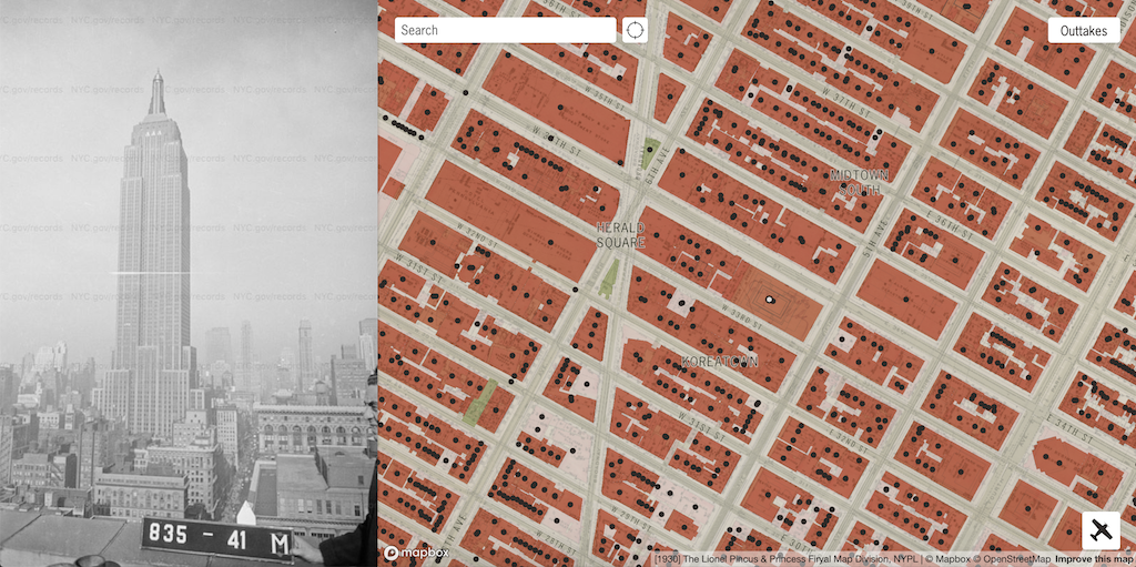


Proud New Yorker Julian Boilen has put together a wonderful interactive map that displays photographs of every building within the five boroughs of New York City that were taken between the years 1939 and 1941 by workers with the Works Progress Administration and the New York City Tax Department.
This photographic count was part of President Franklin D. Roosevelt‘s New Deal to find a way to get 8.5 million unemployed Americans back to work after The Great Depression. The physical photo collecion is housed at the New York Ciy Municipal Archives.
In 2018, the NYC Municipal Archives completed the digitization and tagging of these photos. This website places them on a map.

Financial District, Manhattan

Williamsburg, Brooklyn

The Bronx

Coney Island, Brooklyn

Garment District, Manhattan

Greenpoint, Brooklyn

Lower East Side, Manhattan

Newtown Creek, Queens


Upper West Side, Manhattan
via Paul Stamatiou
Related Posts
80s.NYC, An Online Collection of Street View Photos Taken in All Five Boroughs During the 1980s
NYC Department of Records Releases 870,000 Historical Photos Online
A Colorful Interactive Map That Shows Every Neighborhood Within New York City’s Five Boroughs
A Seaman’s Bank for Savings Subway Map Offers a Nostalgic View of New York City in 1939
An Amusing New York City Map Showing Where the Dogs With the Most Popular Names in 2015 Live
Follow Laughing Squid on Facebook, Twitter, and Subscribe by Email.
The post A Wonderful Interactive Map Featuring Photos of Every Building in New York City Taken From 1939-1941 first appeared on Laughing Squid.


More Stories
Will County, Illinois 1864 Map – May 20, 2023 at 04:14AM
This kid on Google Map trying to get by – April 27, 2023 at 05:05PM
World of Hyatt: Complete list of all-inclusive properties in Europe (with map) – April 27, 2023 at 04:57PM