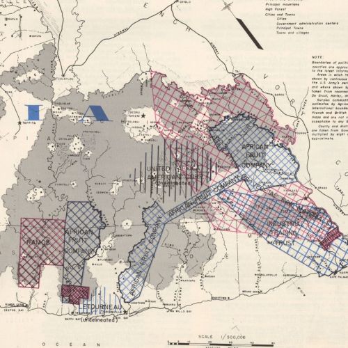


This map of Liberia comes from “Liberia Today,” a publication made by the United States Embassy in Liberia in 1955. This issue of the publication Vol. 4, No. 2. The map’s Note shared that: “Areas in which water courses are shown by continuous lines are mapped from the U.S. Army’s aerial survey “Casey Jones” and where shown by broken lines are taken from reconnaissance maps by De Groot, Harley, and Mellish.” The Note section fails to mention the coloration of the business sections of the map.
326 E-1955


More Stories
Will County, Illinois 1864 Map – May 20, 2023 at 04:14AM
This kid on Google Map trying to get by – April 27, 2023 at 05:05PM
World of Hyatt: Complete list of all-inclusive properties in Europe (with map) – April 27, 2023 at 04:57PM