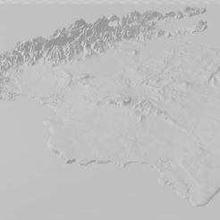

The file shows the geographical profile of the Mediterranean island of Mallorca, which belongs to Spain.
I have already printed the file once with the Creality CR 30 treadmill printer. For this I had to reduce it to 40%. See pictures. I set the wall thickness to 2mm, this has the advantage that the print head only traces the geographic contour accurately. If you print the file on a bed printer, depending on how high the layer thickness is set, and how large the print bed is, you will see the layers as contour lines like on a map. I like printing with the CR 30 better because with a 0.8 mm Nozzel and a layer thickness of 0.3 mm, I only see narrow lines, but only when I get really close. You can certainly print the relief finer, but then it will take longer, but the quality will be better.


More Stories
Will County, Illinois 1864 Map – May 20, 2023 at 04:14AM
This kid on Google Map trying to get by – April 27, 2023 at 05:05PM
World of Hyatt: Complete list of all-inclusive properties in Europe (with map) – April 27, 2023 at 04:57PM